Tag: Archeology

Why Is There No Cave Art in Israel’s Ancient Caves?

Research suggests: extinct animals explain Israel’s lack of cave art.

For over a century, archaeologists have puzzled over the absence of cave art in the Levant in general, and specifically in Israel. Clearly, the reason is not a lack of caves, knowledge, or artistic skill. Now, a team of archaeologists from Tel Aviv University proposes an original explanation: prehistoric humans in the Levant did not create cave paintings because many large animals, the subjects of cave art in Western Europe, were already extinct here – so there was no need to try to depict them for shamanic rituals held deep within caves.

The study was published in an editorial article of the Journal of the Israel Prehistoric Society, authored by a team of researchers from Tel Aviv University’s Jacob M. Alkow Department of Archaeology & Ancient Near Eastern Cultures: Prof. Ran Barkai, Dr. Ilan Dagoni, Dr. Miki Ben-Dor, and Dr. Yafit Kedar.

Prof. Ran Barkai.

The enigma of missing cave art in Israel

“This is a century-old mystery in Israeli archaeological research”, says Prof. Barkai. “The first prehistoric cave excavation in Israel took place in 1925, but frustratingly, not a single cave painting has been found since. In other parts of the world, such as Spain and France, hundreds of spectacular cave paintings have been discovered. Here, nothing. Israel certainly has caves, and many were inhabited by humans during the same period when cave paintings were created in Western Europe – 35,000 to 30,000 years ago. Moreover, according to all material evidence, the people in both regions belonged to the same culture – the Aurignacian culture. Their tools were similar, and their artistic objects, beads and pendants, for example, were also similar. There is no doubt that humans here had the cognitive ability to paint and were no less capable than their European contemporaries”. The mystery around the absence of cave paintings in the Levant grew in recent years, as numerous studies showed that Aurignacian humans in the Levant and Europe were not only biologically and culturally similar, but also maintained contact with each other.

“These were Homo sapiens, modern humans, who probably left Africa 60,000 to 70,000 years ago”, says Prof. Barkai.

Prof. Barkai continues: “They passed through the Levant around 60,000 years ago and arrived in Europe approximately 45,000 years ago. However, new archaeological evidence shows that some returned to Israel, meaning that the migration wasn’t one-way. It seems that humans here and there kept in touch, migrating back and forth – and yet there are cave paintings in Europe and none here. To solve this mystery, we must first answer another big and much-debated question:  Why did humans in Europe paint on cave walls in the first place? We support the hypothesis that cave paintings were created as part of shamanic rituals involving altered states of consciousness, intended to convey messages to entities beyond the cave walls, in underworlds regarded as the source of abundance – asking for solutions to the extinction of large animals on which humans depended for survival”.

Reconstruction of elephant hunting using spears.

What inspired cave art?

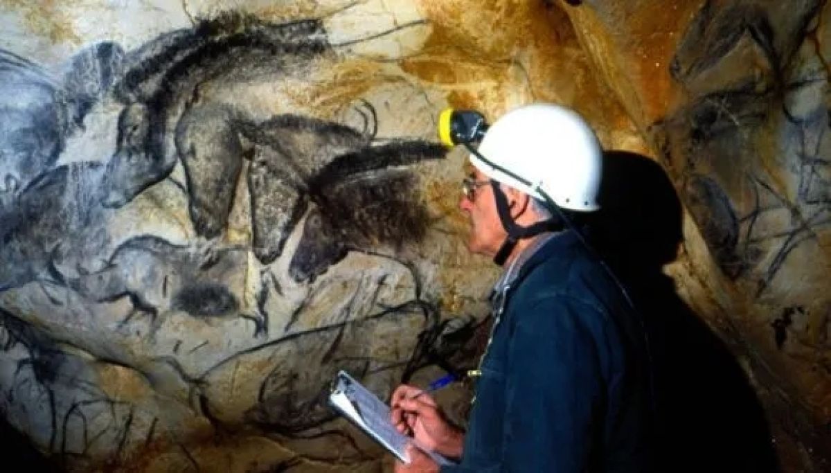
According to the researchers, soon after modern humans first came to Europe, large animals such as woolly mammoths and woolly rhinoceroses began to disappear. These were large, fat-rich animals that prehistoric humans in Europe and elsewhere relied on as their primary food source. Watching these populations diminish, worried prehistoric Europeans ventured deep into caves and painted large animals on their walls. The practice of cave painting came to an end more or less when Europe’s large animals became completely extinct.

“It’s important to understand that cave paintings are found in many cases deep within caves – in places that are difficult and even dangerous to access. We also know from indigenous societies living today that the depths of caves are perceived as gateways to the underworld – a realm of abundance and the source of all things. Therefore, it is customary to appeal to entities from the other side in times of trouble, such as illness or inner conflict. We argue that humans in Europe went deep into caves and painted the vanishing large animals to ask these entities to bring them back, emphasizing their own dependence on large game for their survival. In Israel, we do not find such paintings because when Homo sapiens arrived the large animals were already extinct – eradicated by earlier types of humans. Here, with elephants and rhinoceroses all gone, Homo sapiens were forced to hunt smaller, faster animals. The people who migrated to Europe, on the other hand, found large game once again – woolly mammoths and woolly rhinoceroses. The newly arrived humans felt they had entered paradise, and the animals’ subsequent dwindling, in front of their very eyes, plunged them into a crisis that resulted in cave paintings. Prehistoric humans in Israel experienced no such crisis, only continuity, which is why we don’t see cave paintings here. Their anxieties were different than those of their European counterparts, and so were their rituals. This hypothesis supports our broader thesis that prehistoric humans were aware of their role in the extinction of their food sources”.


Mystery in the Stones: The Truth About Rujm el-Hiri

Geodynamic shifts challenge Rujm el-Hiri’s role as an ancient observatory.

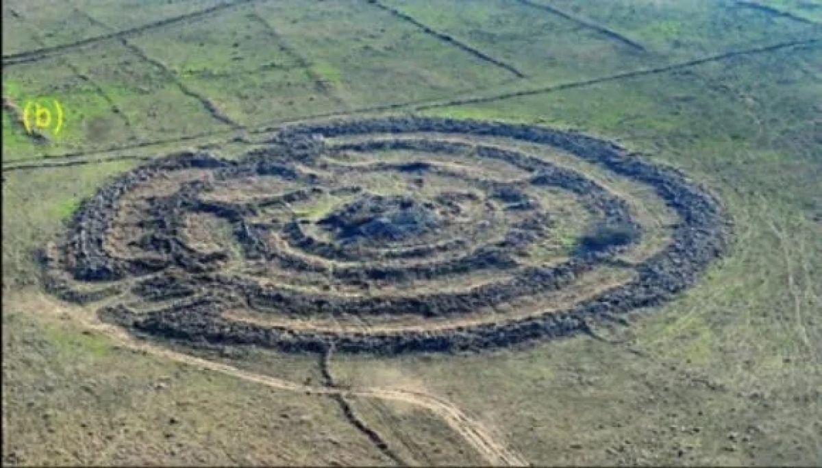
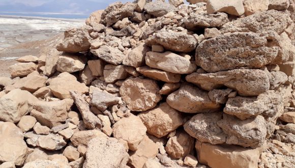
A new study by Tel Aviv University and Ben-Gurion University of the Negev reveals groundbreaking findings about the famous Rujm el-Hiri site (known as the “Wheel of Ghosts”) in the Golan Heights. Based on geomagnetic analysis and tectonic reconstruction, the researchers determined that geodynamic movement over 150 million years, at an average rate of 8–15 mm per year, caused significant shifts in the ground, rotating and reorienting it over millennia. This finding challenges the widely held theory that the structure was used as an astronomical observatory, as the original alignment of the walls and entrances does not correspond to celestial observations, as previously hypothesized.

The study was led by a research team headed by Dr. Olga Khabarova and Prof. Lev Eppelbaum of the Department of Geophysics at the Porter School of the Environment and Earth Sciences, Tel Aviv University, in collaboration with Dr. Michal Birkenfeld of the Department of Archaeology at Ben-Gurion University. The article was published in the prestigious journal Remote Sensing.

Left to right: Dr. Olga Khabarova & Prof. Lev Eppelbaum.

The researchers employed geophysical methods and remote sensing techniques to demonstrate that Rujm el-Hiri’s current orientation differs from its original position due to thousands of years of geodynamic shifts. This discovery raises new questions regarding the site’s possible identification as an observatory. The team conducted initial mapping and documentation of the archaeological landscape within 30 kilometers around the Sea of Galilee. It visually analyzed the region to identify typical landscape features associated with historical human activity and the reconstruction of archaeological objects.

According to the research team, “The study was based on calculations of the sky map and aligning the directions of the solstices, equinoxes, and other celestial bodies as they appeared between 2500–3500 BCE, coordinated with the symmetry and entrances of Rujm el-Hiri in its current position. The findings show that the entrances and radial walls during that historical period were entirely different, reopening the question of the site’s purpose”.

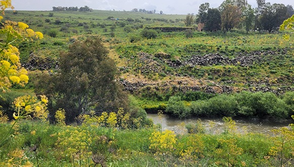
The study also provides the first comprehensive mapping of the archaeological landscape surrounding Rujm El-Hiri, using advanced satellite technology. Unique landscape features were identified, including circular structures with 40–90 meters diameters, thick walls, and round enclosures approximately 20 meters in diameter, which appeared to serve agricultural or herding purposes. Dozens of burial mounds (tumuli) were documented in the area, some of which were likely used as storage facilities, shelters, or dwellings, in addition to their traditional role as burial sites.

The researchers conclude: “This new study not only opens a window to understanding Rujm el-Hiri but also enriches our knowledge of ancient life in the Golan Heights and the connections between various archaeological findings in the area”.

TAU research overturns myths about ancient copper pollution.

A new study from Tel Aviv University overturns prevailing scientific beliefs that King Solomon’s Mines not only harmed workers’ health in the ancient copper industry but also posed risks to the health of modern residents living near the site.

In the new study, researchers conducted geochemical surveys at copper production sites in the Timna Valley, dating back to the 10th century BCE and the era of the Biblical Kings David and Solomon. They found that the environmental pollution from copper production was minimal and spatially restricted, posing no danger to the region’s inhabitants in the past or today. Additionally, TAU’s archaeologists reviewed previous studies and found no evidence that the ancient copper industry polluted the planet.

The study was led by Prof. Erez Ben-Yosef, Dr. Omri Yagel, Willy Ondricek, and Dr. Aaron Greener from the Department of Archaeology and Ancient Near Eastern Cultures from The Lester & Sally Entin Faculty of Humanities at Tel Aviv University. The paper was published in the prestigious journal Scientific Reports by Nature.

פרופ' ארז בן יוסף

Prof. Erez Ben-Yosef.

Did Ancient Copper Mines Really Cause Pollution?

“We inspected two major copper production sites in the Timna Valley, one from the Iron Age and King Solomon’s era and another nearby that is about 1,500 years older”, says Prof. Erez Ben-Yosef. “Our study was extensive.  We took hundreds of soil samples from both sites for chemical analyses, creating high-resolution maps of heavy metal presence in the region. We found that pollution levels at the Timna copper mining sites are extremely low and confined to the locations of the ancient smelting furnaces. For instance, the concentration of lead — the primary pollutant in metal industries — drops to less than 200 parts per million just a few meters from the furnace. By comparison, the U.S. Environmental Protection Agency defines industrial areas as safe for workers at 1,200 parts per million and residential areas as safe for children at 200 parts per million”.

The new study contradicts a series of papers published since the 1990s about pollution caused allegedly by the ancient copper industry. “We demonstrate that this is not true. Pollution in Timna is very restricted spatially, and only those working directly at the furnace likely suffered from inhaling toxic fumes, while just a short distance away, the soil is entirely safe. Moreover, the match we found between the spatial distribution of copper and lead concentrations in the soil further indicates that the metals are ‘trapped’ in slag and other industrial waste – which keeps them from leaching into the soil and affecting plants or humans. Our findings align with several recent studies from the Wadi Faynan region in Jordan, which also point to very low levels of pollution. Timna and Faynan are ideal sites for this type of research because they have not been disturbed by modern mining, as happened in Cyprus for example, and thanks to their dry climates the metals in the soil are not washed away. In Faynan, a team led by Prof. Yigal Erel of the Hebrew University examined 36 skeletons of people who lived at the mining site during the Iron Age, and only three showed any trace of pollution in their teeth. The rest were completely clean. We now present a similar picture for Timna”. In addition to the geochemical survey, the TAU archaeologists also conducted a comprehensive review of existing literature, pointing out that hypotheses about global pollution during the pre-Roman period lack solid evidence.

Dr. Omri Yagel recording the precise sampling location. 

Clearing the Record: Not What We Thought

“There was a trend in the 1990s, which presented ancient copper production as the first instance of industrial pollution”, explains Dr. Omri Yagel, a leading researcher in the current study. “Such statements grab headlines and attract research grants, but they unnecessarily project modern pollution problems onto the past. Moreover, the research literature tends to use the term ‘pollution’ to describe any trace of ancient metallurgical activity, and this has led to the mistaken assumption that metal industries were harmful to humans from their earliest beginnings — which is patently untrue. Even when metal production was large-scale, becoming integral to human civilization, it was the toxic lead industry that caused global pollution, not necessarily other metals. A 1990s study argued that traces of copper found in Greenland ice cores had traveled through the atmosphere from sites like Timna. This claim, however, has not been corroborated by any subsequent study.  As modern researchers grappling with the consequences of climate change, we have an inherent tendency to seek similar shifts in the past, but we must be careful. We may call a few pieces of slag lying on the ground ‘pollution’, but we should not confuse this local waste with regional or global environmental pollution”.

Is This the Birthplace of Religious Rituals?

A rare discovery of early rituals in the levant.

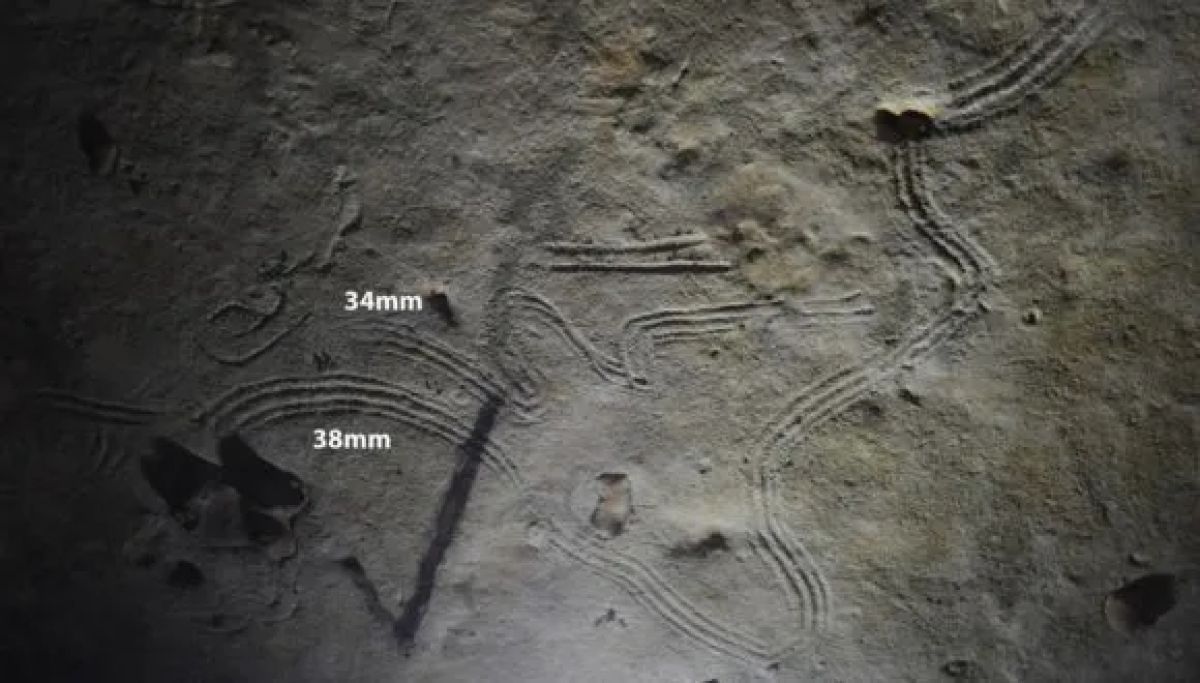
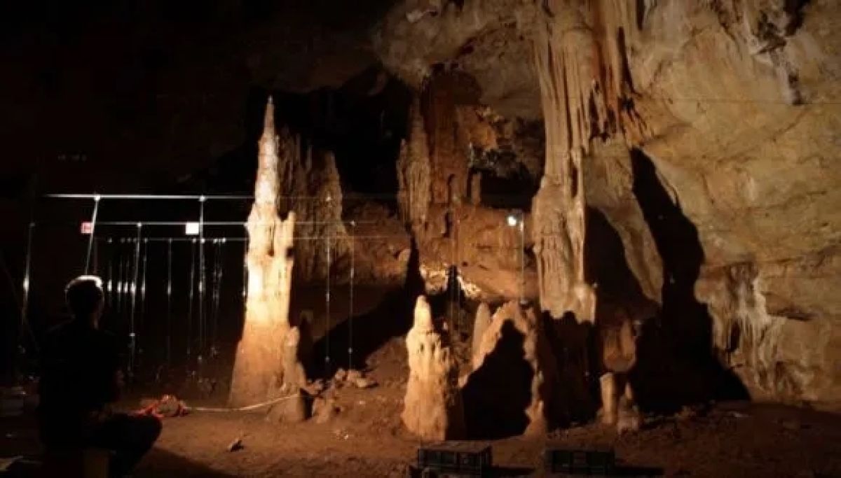
A rare prehistoric ritual complex has been uncovered in the darkest depths of Manot Cave in Western Galilee, Israel. The complex is enclosed naturally by impressive stalagmites that create a distinctive entrance to the site and feature a unique and impressive rock with geometric engravings resembling a turtle shell. The study of this complex, published in the journal PNAS, was led by Dr. Omry Barzilai from the University of Haifa and Israel Antiquities Authority, Prof. Ofer Marder from Ben-Gurion University, and Prof. Israel Hershkovitz from Tel Aviv University.

“The rare discovery provides a glimpse into the spiritual world of Paleolithic hunter-gatherer groups who lived in our region approximately 35,000 years ago. The engraved rock was deliberately placed in a niche in the deepest, darkest part of the cave. The turtle-shell design, carved on a three-dimensional object, indicates that it may have represented a totem or a mythological or spiritual figure. Its special location, far from the daily activity areas near the cave entrance, suggests it was an object of worship. Notably, there are prehistoric caves in Western Europe, with similar findings testifying these places held symbolic importance and served for ritual and communal activities”, said Dr. Barzilai.

Research team (Left to right): Prof. Ofer Marder, Prof. Israel Hershkovitz & Dr. Omry Barzilai. Photo credit: Dr. Omry Barzilai.

Manot Cave has been excavated systematically since 2010 by the Israel Antiquities Authority, Tel Aviv University, and Ben-Gurion University. The cave is particularly well-known for its stunning stalactites and remains of habitation from several prehistoric cultures of the Upper Paleolithic period. Among its notable discoveries is a 55,000-year-old modern human skull, the oldest modern human fossil found outside Africa.

Ancient Rituals That Shaped Early Societies

In the course of study of the deep complex study, the researchers uncovered ash remains in one of the stalagmite rings near the engraved rock, confirming the use of fire to illuminate the ritual space, likely with torches. Acoustic tests revealed that the complex has enhanced natural acoustics, which could have created a unique auditory experience for communal activities such as prayer, singing, and dancing. Prof. Hershkovitz: “This is an unprecedented discovery of a space with ‘audio-visual equipment’ centered around a ritual object (the turtle), constituting the first evidence of communal rituals in the Levant. It is no surprise that prehistoric hunters chose to conduct their rituals in the darkest part of Manot Cave, as darkness embodies sacred and hidden qualities, symbolizing rebirth and renewal. Establishing ritual centers during the Upper Paleolithic was a central element in the development and institutionalization of collective identity — a necessary stage in the transition from small, isolated hunter-gatherer groups based on blood ties between individuals to large, complex societies”.

The chronological age of the ritual complex in Manot Cave was dated to 35,000–37,000 years ago, a period associated with the sudden emergence of the Aurignacian culture, known in Europe for its symbolic objects and cave paintings. “In our excavations in Manot Cave, we uncovered rich Aurignacian layers near the cave entrance that included flint tools, bone and antler implements, and shell beads”, said Prof. Ofer Marder from Ben-Gurion University.

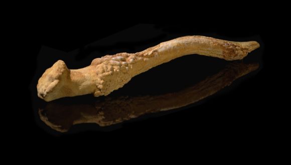
In a small, hidden chamber adjacent to the ritual complex, a complete deer antler with signs of use was discovered. “Antlers were used as raw material for crafting tools for various purposes by Upper Paleolithic cultures in Europe, and by the Aurignacian culture in the Levant. The placement of the deer antler in a hidden chamber adjacent to the ritual site may be connected to the ritual activities in the cave”, explained Dr. Barzilai.

A deer beam from the hidden hall in Manot Cave (Photo credit: Dafna Gazit, Israel Antiquities Authority).

The geometric engravings found on the turtle shell-shaped rock were scanned with a unique confocal microscope capable of capturing extremely thin horizontal sections. “We identified fine micro-linear scratches inside some of the grooves, confirming without a doubt that the engravings are the work of human hands. These carvings are evidence of our ancestors’ artistic skills and their deep connection to rituals and symbols”, said Prof. Rachel Sarig from the Dental Medicine Laboratory at Tel Aviv University, who conducted the scans.

A turtle shell-shaped rock with geometric carvings (Photo credit: Clara Amit, Israel Antiquities Authority).

The researchers also conducted 3D photographic mapping of the cave. “We found a clear separation between the ritual complex and the areas of regular activity at the cave entrance. This observation strengthens the hypothesis about the significance of the complex and the need to differentiate it from the areas where daily activity took place”, said Alexander Wigman from the Israel Antiquities Authority.

According to the researchers, the discovery of the ritual complex in Manot Cave sheds new light on the spiritual life of the Upper Paleolithic people in the Levant. “This research enriches our understanding of prehistoric humans, their symbolic world, and the nature of the worship rituals that connected ancient communities. Identifying communal rituals in the Paleolithic era marks a breakthrough in our understanding of human society and offers more than just a glimpse into ancient ritual practices. It reveals the central role of rituals and symbols in shaping collective identity and strengthening social bonds”, the researchers concluded.

The Manot Cave project is supported by the Dan David Foundation, the Israel Science Foundation, the United States-Israel Binational Science Foundation, the Irene Levi Sala CARE Archaeological Foundation, and the Leakey Foundation. The research involved experts from the Israel Antiquities Authority, Cleveland State University, the Geological Survey of Israel, the Hebrew University of Jerusalem, the University of Haifa, Tel Aviv University, Ben-Gurion University, the University of Vienna, the University of Barcelona, the University of Siena, and Simon Fraser University.

Crushing the Longtime Myth of Masada

TAU archaeologists reveal the Roman siege of Masada likely lasted weeks, not years, according to new research findings.

Researchers from the Sonia & Marco Nadler Institute of Archaeology at Tel Aviv University used various modern technologies, including drones, remote sensing, and 3D digital modeling, to generate the first objective, quantified analysis of the Roman siege system at Masada. Findings indicate that contrary to the widespread myth, the Roman army’s siege of Masada in 73 CE lasted no more than a few weeks.

The study was conducted by the Neustadter expedition from TAU’s Sonia & Marco Nadler Institute of Archaeology, headed by Dr. Guy Stiebel, together with Dr. Hai Ashkenazi (today Head of Geoinformatics at the Israel Antiquities Authority), and PhD candidates Boaz Gross (from Tel Aviv University and the Israeli Institute of Archaeology) and Omer Ze’evi-Berger (today at the University of Bonn). The study is part of the expedition’s extensive mission, implementing advanced tools and posing fresh questions, to attempt a new understanding of what really happened at Masada. The paper was published in the Journal of Roman Archaeology.


Dr. Guy Stiebel

New Tech Reveals Old Secrets

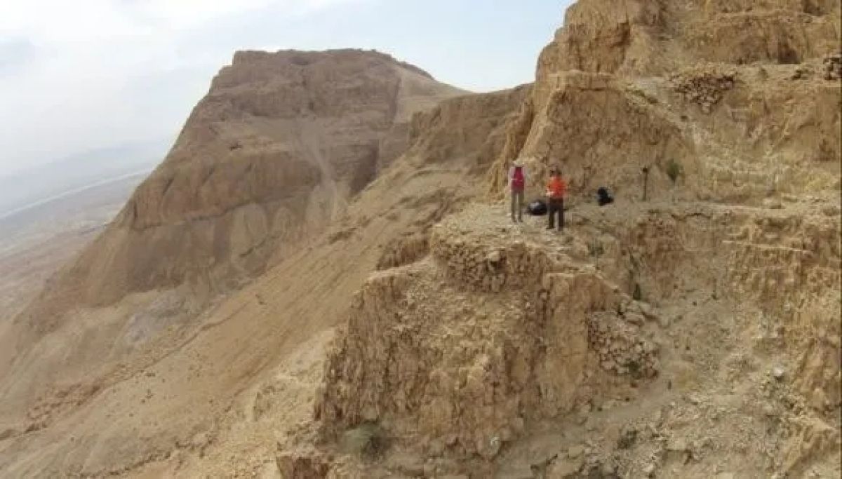
Dr. Stiebel: “In 2017 my expedition renewed, on behalf of TAU’s Sonia & Marco Nadler Institute of Archaeology, excavations at Masada – a world-famous site explored extensively since the early 19th century and throughout the 20th century. Our expedition sets forward several new questions and implements many novel research tools that were not available to previous generations of archaeologists. In this way, we intend to obtain fresh insights into what actually happened there before, during, and after the Great Jewish Revolt. As part of this extensive project, we devote much scholarly attention to the site’s surroundings. We use drones, remote sensing, and aerial photography to collect accurate high-resolution data from Masada and its environs, emphasizing three aspects: the water systems, the trails leading to and from the palatial fortress, and the Roman siege system. The collected information is used to build 3D digital models that provide a clear and precise image of the relevant terrains. In the current study, we focused on the siege system, which, thanks to the remote location and desert climate, is the best-preserved Roman siege system in the world”.

3D model of Tower 7 and the circular feature to its left, view to the west. Photo CreditThe Neustadter Masada Expedition, taken from the Journal of Roman Archaeology.

Dr. Stiebel adds: “For many years, the prevailing theory that became a modern myth asserted that the Roman siege of Masada was a grueling three-year affair. In recent decades researchers have begun to challenge this notion, for various reasons. In this first-of-its-kind study, we examined the issue with modern technologies enabling precise objective measurements”.

3D model of the ramp/staircase, view to the southwest. Photo CreditThe Neustadter Masada Expedition, taken from the Journal of Roman Archaeology.

The researchers used drones carrying remote sensors that provided precise, high-resolution measurements of the height, width, and length of all features of the siege system. This data was used to build an accurate 3D digital model, enabling exact calculation of the structures’ volume and how long it took to build them.

What Really Happened at Masada?

Dr. Ashkenazi: “Reliable estimates are available of the quantity of earth and stones a Roman soldier was able to move in one day. We also know that approximately 6,000-8,000 soldiers participated in the siege of Masada. Thus, we were able to objectively calculate how long it took them to build the entire siege system – eight camps and a stone wall surrounding most of the site. We found that construction took merely about two weeks. Based on the ancient historical testimony it is clear that once the assault ramp was completed, the Romans launched a brutal attack, ultimately capturing the fortress within a few weeks, at the most. This leads us to the conclusion that the entire siege of Masada lasted no more than several weeks”.

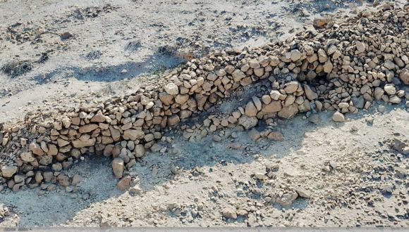
Tower 10 and the wall abutting it. Photo CreditThe Neustadter Masada Expedition, taken from the Journal of Roman Archaeology.

The Truth Behind Masada’s Brief Siege

Dr. Stiebel: “The narrative of Masada, the Great Jewish Revolt, the siege, and the tragic end as related by Flavius Josephus, have all become part of Israeli DNA and the Zionist ethos, and are well known around the world. The duration of the siege is a major element in this narrative, suggesting that the glorious Roman army found it very difficult to take the fortress and crush its defenders. For many years it was assumed that the siege took three long years, but in recent decades researchers have begun to challenge this unfounded belief. In our first-of-its-kind study, we used objective measurements and advanced technologies to clarify this issue with the first data-driven scientific answer. Based on our findings we argue that the Roman siege of Masada took a few weeks at the most.”.


“As empires throughout history have done, the Romans came, saw, and conquered, quickly and brutally quelling the uprising in this remote location. Our conclusion, however, detracts nothing from the importance of this historical event, and many baffling questions remain to be investigated”- Dr. Stiebel.


He continues: “For example: Why did the Romans put so much effort into seizing this remote and seemingly unimportant fortress? To answer this and many other intriguing questions we have initiated a vast, innovative project in and around Masada – collecting data and analyzing it thoroughly in the labs of TAU’s Sonia & Marco Nadler Institute of Archaeology, in collaboration with other researchers, to ultimately shed new light on the old enigma: What really happened at Masada?”

How Did Prehistoric Stone Tools Evolve After Elephants Disappeared?

TAU study identifies tools developed by early humans for butchering fallow deer after elephants disappeared.

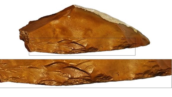
A new study from Tel Aviv University identified the earliest appearance worldwide of special stone tools, used 400,000 years ago to process fallow deer. The tools, called Quina scrapers (after the site in France where they were first discovered), were unearthed at the prehistoric sites of Jaljulia and Qesem Cave. They are characterized by a sharp working edge shaped as scales, enabling users to butcher their prey and also process its hides.

The researchers explain that after the elephants disappeared from the region, the ancient hunters were forced to make technological adaptations enabling them to hunt, butcher, and process much smaller and quicker game – fallow deer. The study also found that the unique tools were made of non-local flint procured from the Mountains of Samaria, which probably also served as the fallow deers’ calving area, about 20km east of Jaljulia and Qesem Cave. Consequently, the researchers hypothesize that Mounts Ebal and Gerizim (near Nablus of today) were considered a source of plenty and held sacred by prehistoric hunters as early as the Paleolithic period.

The study was led by Vlad Litov and Prof. Ran Barkai of Tel Aviv University’s Jacob M. Alkow Department of Archaeology and Ancient Near Eastern Cultures. The paper was published in Archaeologies.

Prof. Ran Barkai

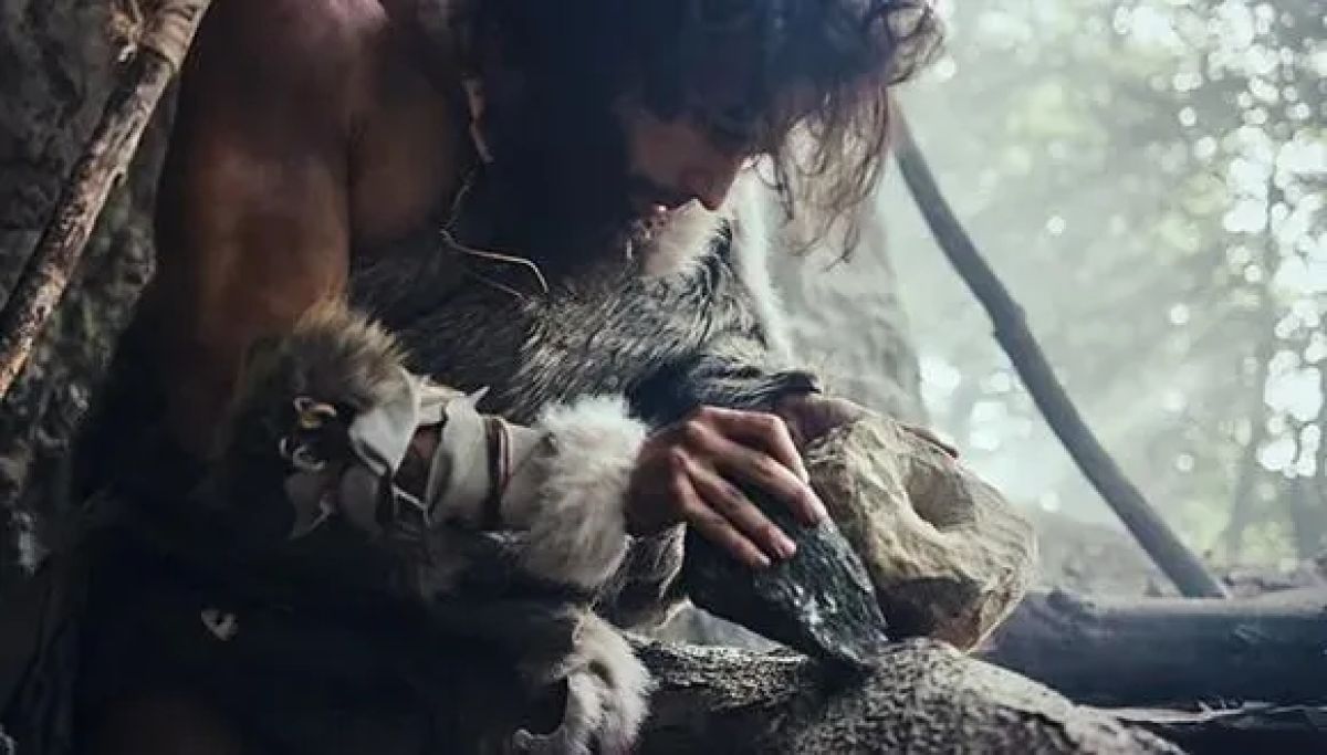
The researchers explain that for about a million years, starting 1.5 million years ago, early humans used stone tools called scrapers to process hides and scrape the flesh off the bones of mostly large game. In the Levant, they mainly hunted elephants and other large herbivores that provided most of the calories they needed. The study found, however, that about 400,000 years ago, following the elephants’ disappearance, hunters turned to a different kind of prey, considerably smaller and quicker than elephants – fallow deer.

How Changing Diets Shaped Prehistoric Tools

Litov explains: “In this study, we tried to understand why stone tools changed during prehistoric times, with a focus on a technological change in scrapers in the Lower Paleolithic, about 400,000 years ago. We found a dramatic change in the human diet during this period, probably resulting from a change in the available fauna: the large game, particularly elephants, had disappeared, and humans were forced to hunt smaller animals, especially fallow deer. Clearly, butchering a large elephant is one thing, and processing a much smaller and more delicate fallow deer is quite a different challenge. Systematic processing of numerous fallow deer to compensate for a single elephant was a complex and demanding task that required the development of new implements. Consequently, we see the emergence of the new Quina scrapers, with a better-shaped, sharper, more uniform working edge compared to the simple scrapers used previously”.

A close look at a Quina-like scraper from Jaljulia.

The study relies on findings from an excavation at the Jaljulia prehistoric site next to Highway 6 in central Israel, probably inhabited by humans of the homo erectus species, as well as evidence from the nearby Qesem Cave. At both sites the excavators discovered many scrapers of the new type, made of non-local flint whose nearest sources are the western slopes of Samaria, to the east of the excavated sites, or today’s Ben Shemen Forest to the south.

Prof. Barkai adds: “In this study we identified links between technological developments and changes in the fauna hunted and consumed by early humans. For many years researchers believed that the changes in stone tools resulted from biological and cognitive changes in humans. We demonstrate a double connection, both practical and perceptual. On the one hand, humans started making more sophisticated tools because they had to hunt and butcher smaller, faster, thinner game. On the other, we identify a perceptual connection: Mounts Ebal and Gerizim in Samaria, about 20km east of Jaljulia, were a home range of fallow deer and thus considered a source of plenty. We found a connection between the plentiful source of fallow deer and the source of flint used to butcher them, and we believe that this link held perceptual significance for these prehistoric hunters. They knew where the fallow deer came from and made special efforts to use flint from the same area to make tools for butchering this prey. This behavior is familiar from many other places worldwide and is still widely practiced by native hunter-gatherer communities”.

Samaria’s Sacred Role in Early Tool Evolution

Litov concludes: “We believe that the Mountains of Samaria were sacred to the prehistoric people of Qesem Cave and Jaljulia because that’s where the fallow deer came from. It’s important to note that in Jaljulia we also found numerous other tools made of different kinds of locally-procured stones. When the locals realized that the elephant population was dwindling, they gradually shifted their focus to fallow deer. Identifying the deer’s plentiful source, they began to develop the unique scrapers in the same place. This is the earliest instance of a phenomenon that later spread throughout the world. The new scrapers first appeared at Jaljulia on a small scale, about 500,000 years ago, and a short time later, 400,000 to 200,000 years ago, on a much larger scale at Qesem Cave. The Samarian highlands east of Jaljulia and Qesem Cave were likely the home range of a fallow deer population, as evidenced by bone remains recovered from local archaeological sites throughout the Pleistocene and Holocene. Many fallow deer bones were also found at the altar site on Mount Gerizim, attributed in the Old Testament to Joshua bin Nun, and identified by some traditions as the place of Abraham’s Covenant of the Pieces described in the Book of Genesis. Apparently, the Mountains of Samaria gained a prominent, or even sacred status as early as the Paleolithic period and retained their unique cultural position for hundreds of thousands of years”.

Why Did Early Humans Prefer to Hunt Near Water Sources?

Elephant Hunting and Stone Quarries in the Paleolithic Era

Archaeologists from Tel Aviv University have uncovered the mystery surrounding extensive Paleolithic stone quarrying and tool-making sites: Why did Homo erectus repeatedly revisit the very same locations for hundreds of thousands of years? The answer lies in the migration routes of elephants, which they hunted and dismembered using flint tools crafted at these quarrying sites.

The research was led by Dr. Meir Finkel and Prof. Ran Barkai of Tel Aviv University’s Jacob M. Alkow Department of Archaeology and Ancient Near Eastern Cultures. The study was published in the journal Archaeologies.

Prof. Ran Barkai.

Prof. Ran Barkai explains: “Ancient humans required three things: water, food, and stone. While water and food are necessities for all creatures, humans relied on stone tools to hunt and butcher animals, as they lacked the sharp claws or fangs of other predators. The question is, why do we find rock outcrops that were used for the production of flint tools, surrounded by thousands of stone tools, and next to them rock outcrops containing flint that was not used for the production of tools? A study of indigenous groups that lived until recently, with some still alive today, shows that hunter-gatherers attribute great importance to the source of the stone — the quarry itself — imbuing it with potency and sanctity, and hence also spiritual worship. People have been making pilgrimages to such sites for generations upon generations, leaving offerings at the rock outcrop, while adjacent outcrops, equally suitable for stone tool production, remain untouched. We sought to understand why; what is special about these sites?”

How did elephant migration routes affect prehistoric quarry locations?

For nearly 20 years, Prof. Barkai and his colleagues have been researching flint quarrying and tool-making sites in the Upper Galilee. These sites are characterized by large nodules of flint convenient for crafting and are located within walking distance of the major Paleolithic sites of the Hula Valley — Gesher Benot Ya’akov and Ma’ayan Baruch. These sites boast thousands of quarrying and extraction localities where, until half a million years ago, in the Lower Paleolithic period, prehistoric humans fashioned tools and left offerings, despite the presence of flint in other geological formations in various places. Because elephants were the primary dietary component for these early humans, the Tel Aviv University researchers cross-referenced the database of the sites’ distribution with the database of the elephants’ migration routes and discovered that the flint quarrying and knapping sites were situated in rock outcrops near the elephants’ migration paths.

“An elephant consumes 400 liters of water a day on average, and that’s why it has fixed movement paths,” says Dr. Finkel. “These are animals that rely on a daily supply of water, and therefore on water sources — the banks of lakes, rivers and streams. In many instances, we discover elephant hunting and processing sites at “necessary crossings” — where a stream or river passes through a steep mountain pass, or when a path along a lakeshore is limited to the space between the shore and a mountain range. At the same time, given the absence of available means of preservation and the presence of predatory animals in the area, the window of opportunity for a group of hunter-gatherers to exhaust their elephant prey was limited. Therefore, it was imperative to prepare suitable cutting tools in large quantities in advance and nearby. For this reason, we find quarrying and knapping sites in the Upper Galilee located a short distance from elephant butchering sites, which are positioned along the elephants’ movement paths.”

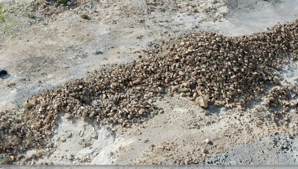
Quarries and flint piles in the Galilee (Photo: Meir Finkel).

Subsequently, the researchers sought to apply an adapted model from the one they developed in Israel to several sites from the Lower Paleolithic period in Asia, Europe and Africa, where such a “triad” exists. These included both sites where the hunted animals were elephants or mammoths, as well as later sites where other animals, such as hippos, camels, and horses, were the prey.

“It appears that the Paleolithic holy trinity holds true universally: Wherever there was water, there were elephants, and wherever there were elephants, humans had to find suitable rock outcrops to quarry stone and make tools in order to hunt and butcher their favorite megaherbivores”, says Prof. Barkai.

“It was a tradition: For hundreds of thousands of years, the elephants wandered along the same route, while humans produced stone tools nearby. Ultimately, those elephants became extinct, and the world changed forever” – Prof. Barkai.

New Technology Interprets Archaeological Findings from Biblical Times

Researchers rely on the earth’s magnetic field to verify an event mentioned in the Old Testament.

A breakthrough achieved by researchers from four Israeli universities – Tel Aviv University, The Hebrew University of Jerusalem, Bar-Ilan University and Ariel University– will enable archaeologists to identify burnt materials discovered in excavations and estimate their firing temperatures. Applying their method to findings from ancient Gath (Tell es-Safi in central Israel), the researchers validated the Biblical account: “About this time Hazael King of Aram went up and attacked Gath and captured it. Then he turned to attack Jerusalem” (2 Kings 12, 18). They explain that unlike previous methods, the new technique can determine whether a certain item (such as a mud brick) underwent a firing event even at relatively low temperatures, from 200°C and up. This information can be crucial for correctly interpreting the findings.

The multidisciplinary study was led by Dr. Yoav Vaknin from the Sonia & Marco Nadler Institute of Archaeology, Entin Faculty of Humanities, at Tel Aviv University, and the Palaeomagnetic Laboratory at The Hebrew University. Other contributors included: Prof. Ron Shaar from the Institute of Earth Sciences at The Hebrew University, Prof. Erez Ben-Yosef and Prof. Oded Lipschits from the Sonia & Marco Nadler Institute of Archaeology at Tel Aviv University, Prof. Aren Maeir from the Martin (Szusz) Department of Land of Israel Studies and Archaeology at Bar-Ilan University and Dr. Adi Eliyahu Behar from the Department of Land of Israel Studies and Archaeology and the Department of Chemical Sciences at Ariel University. The paper has been published in the scientific journal PLOS ONE.

Prof. Lipschits: “Throughout the Bronze and Iron Ages the main building material in most parts of the Land of Israel was mud bricks. This cheap and readily available material was used to build walls in most buildings, sometimes on top of stone foundations. That’s why it’s so important to understand the technology used in making these bricks.”

Dr. Vaknin adds: “During the same era dwellers of other lands, such as Mesopotamia where stone was hard to come by, would fire mud bricks in kilns to increase their strength and durability. This technique is mentioned in the story of the Tower of Babel in the Book of Genesis: “They said one to another, Come, let us make bricks and fire them thoroughly. So they used brick for stone”(Genesis 11, 3). Most researchers, however, believe that this technology did not reach the Land of Israel until much later, with the Roman conquest. Until that time the inhabitants used sun-dried mud bricks. Thus, when bricks are found in an archaeological excavation, several questions must be asked: First, have the bricks been fired, and if so, were they fired in a kiln prior to construction or in situ, in a destructive conflagration event? Our method can provide conclusive answers.”

The new method relies on measuring the magnetic field recorded and ‘locked’ in the brick as it burned and cooled down. Dr. Vaknin: “The clay from which the bricks were made contains millions of ferromagnetic particles – minerals with magnetic properties that behave like so many tiny ‘compasses’ or magnets. In a sun-dried mud brick the orientation of these magnets is almost random, so that they cancel out one another. Therefore, the overall magnetic signal of the brick is weak and not uniform. Heating to 200°C or more, as happens in a fire, releases the magnetic signals of these magnetic particles and, statistically, they tend to align with the earth’s magnetic field at that specific time and place. When the brick cools down, these magnetic signals remain locked in their new position and the brick attains a strong and uniformly oriented magnetic field, which can be measured with a magnetometer. This is a clear indication that the brick has, in fact, been fired.
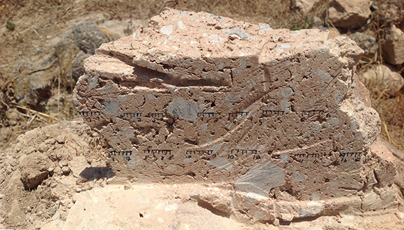
One of the studied burnt mudbricks (Photo credit: Dr. Yoav Vaknin)

In the second stage of the procedure, the researchers gradually ‘erase’ the brick’s magnetic field, using a process called thermal demagnetization. This involves heating the brick in a special oven in a palaeomagnetic laboratory that neutralizes the earth’s magnetic field. The heat releases the magnetic signals, which once again arrange themselves randomly, canceling each other out, and the total magnetic signal becomes weak and loses its orientation.

Dr. Vaknin: “We conduct the process gradually. At first, we heat the sample to a temperature of 100°C, which releases the signals of only a small percentage of the magnetic minerals. We then cool it down and measure the remaining magnetic signal. We then repeat the procedure at temperatures of 150°C, 200°C, and so on, proceeding in small steps, up to 700°C. In this way the brick’s magnetic field is gradually erased. The temperature at which the signal of each mineral is ‘unlocked’ is approximately the same as the temperature at which it was initially ‘locked’, and ultimately, the temperature at which the magnetic field is fully erased was reached during the original fire.”

The researchers tested the technique in the laboratory: they fired mud bricks under controlled conditions of temperature and magnetic field, measured each brick’s acquired magnetic field, then gradually erased it. They found that the bricks were completely demagnetized at the temperature at which they had been burned – proving that the method works.

Dr. Vaknin: “Our approach enables identifying burning which occurred at much lower temperatures than any other method. Most techniques used for identifying burnt bricks are based on actual changes in the minerals, which usually occur at temperatures higher than 500°C – when some minerals are converted into others.”

Dr. Eliyahu Behar: “One of the common methods for identifying mineralogical changes in clay (the main component of mud bricks) due to exposure to high temperatures is based on changes in the absorption of infrared radiation by the various minerals. In this study we used this method as an additional tool to verify the results of the magnetic method.” Dr. Vaknin: “Our method is much more sensitive than others because it targets changes in the intensity and orientation of the magnetic signal, which occur at much lower temperatures. We can begin to detect changes in the magnetic signal at temperatures as low as 100°C, and from 200°C and up the findings are conclusive.”

In addition, the method can determine the orientation in which the bricks cooled down. Dr. Vaknin: “When a brick is fired in a kiln before construction, it records the direction of the earth’s magnetic field at that specific time and place. In Israel this means north and downward. But when builders take bricks from a kiln and build a wall, they lay them in random orientations, thus randomizing the recorded signals. On the other hand, when a wall is burned in-situ, as might happen when it is destroyed by an enemy, the magnetic fields of all bricks are locked in the same orientation.”

After proving the method’s validity, the researchers applied it to a specific archaeological dispute: was a specific brick structure discovered at Tell es-Safi – identified as the Philistine city of Gath, home of Goliath – built of pre-fired bricks or burned on location? The prevalent hypothesis, based on the Old Testament, historical sources, and Carbon-14 dating attributes the destruction of the structure to the devastation of Gath by Hazael, King of Aram Damascus, around 830 BCE. However, a previous paper by researchers including Prof. Maeir, head of the Tell es-Safi excavations, proposed that the building had not burned down, but rather collapsed over decades, and that the fired bricks found in the structure had been fired in a kiln prior to construction. If this hypothesis were correct, this would be the earliest instance of brick-firing technology discovered in the Land of Israel.

To settle the dispute, the current research team applied the new method to samples from the wall at Tell es-Safi and the collapsed debris found beside it. The findings were conclusive: the magnetic fields of all bricks and collapsed debris displayed the same orientation – north and downwards. Dr. Vaknin: “Our findings signify that the bricks burned and cooled down in-situ, right where they were found, namely in a conflagration in the structure itself, which collapsed within a few hours. Had the bricks been fired in a kiln and then laid in the wall, their magnetic orientations would have been random. Moreover, had the structure collapsed over time, not in a single fire event, the collapsed debris would have displayed random magnetic orientations. We believe that the main reason for our colleagues’ mistaken interpretation was their inability to identify burning at temperatures below 500°C. Since heat rises, materials at the bottom of the building burned at relatively low temperatures, below 400°C, and consequently the former study did not identify them as burnt – leading to the conclusion that the building had not been destroyed by fire. At the same time, bricks in upper parts of the wall, where temperatures were much higher, underwent mineralogical changes and were therefore identified as burnt – leading the researchers to conclude that they had been fired in a kiln prior to construction. Our method allowed us to determine that all bricks in both the wall and debris had burned during the conflagration: those at the bottom burned at relatively low temperatures, and those that were found in higher layers or had fallen from the top –at temperatures higher than 600°C.”

Prof. Maeir: “Our findings are very important for deciphering the intensity of the fire and scope of destruction at Gath, the largest and most powerful city in the Land of Israel at the time, as well as understanding the building methods prevailing in that era. It’s important to review conclusions from previous studies, and sometimes even refute former interpretations, even if they came from your own school.” Prof. Ben-Yosef adds: “Beyond their historical and archaeological significance, ancient building methods also had substantial ecological implications. The brick firing technology requires vast quantities of combustive materials, and in ancient times this might have led to vast deforestation and even loss of tree species in the area. For example, certain species of trees and shrubs exploited by the ancient copper industry in the Timna Valley have not recovered to this day and the industry itself ultimately collapsed once it had used up its natural fuels. Our findings indicate that the brick firing technology was probably not practiced in the Land of Israel in the times of the Kings of Judah and Israel.”

Unearthing Ancient Intelligence

Early humans in Israel’s Hula Valley invested in systematic procurement of raw materials hundreds of thousands of years ago – much earlier than previously assumed.

A new study from Tel Aviv University and Tel-Hai College solves an old mystery: Where did early humans in the Hula Valley, in northern Israel, get flint to make the prehistoric tools known as hand axes? The researchers applied advanced methods of chemical analysis and AI to identify the geochemical fingerprints of hand axes from the Hula Valley’s oldest prehistoric sites, Ma’ayan Barukh and Gesher Benot Ya’aqov. Their findings indicate that the raw material came from exposures of high-quality flint in the Dishon Plateau, about 20km to the west, and hundreds of meters above the Hula Valley. The researchers: “Our findings indicate that these early humans had high social and cognitive abilities: they were familiar with their surroundings, knew the available resources, and made great efforts to procure the high-quality raw materials they needed. For this purpose, they planned and carried out long journeys, and transferred this essential knowledge to subsequent generations.”


“Our findings indicate that early humans were highly capable: they planned and implemented complex strategies and passed on essential information from one generation to the next.” – The researchers


Early Humans’ Versatile “Swiss Army Knife”

The study was led by Dr. Meir Finkel of the Department of Archaeology and Ancient Near East Cultures, Tel Aviv University and Prof. Gonen Sharon of the MA Program in Galilee Studies, Tel-Hai College, in collaboration with Prof. Erez Ben-Yosef, Tel Aviv University, Dr. Oded Bar and Dr. Yoav Ben Dor, the Geological Survey of Israel, and Ofir Tirosh, the Hebrew University. The paper was published in Geoarchaeology.

Dr. Finkel: “The Hula Valley, located along the Dead Sea Transform Rift, is well known for its many prehistoric sites, the oldest of which date back to 750,000 years before present (YBP). The valley offered early humans rich sources of water, vegetation, and game, right on the northward migration route from Africa – the Great African Rift Valley. These early inhabitants left behind them many artifacts, including thousands of hand axes – flint stones chiseled to fit the human hand. One of the earliest and most universal tools produced by humans, the hand axe may have served as a multipurpose ‘penknife’ for many different tasks, from cutting game meat to digging for water and extracting roots. It was used in many different parts of the Old World, in Africa, Asia, and Europe, for about 1.5 million years.”


“One of the earliest and most universal tools produced by humans, the hand axe may have served as a multipurpose ‘penknife’ for many different tasks, from cutting game meat to digging for water and extracting roots.” –  Dr. Meir Finkel


In the present study the researchers looked for the source of the raw material used to produce thousands of hand axes found at two prehistoric sites in the Hula Valley: Gesher Benot Ya’aqov, dated to 750,000 YBP and Ma’ayan Barukh, dated to 500,000 YBP, both Acheulian.  Prof. Sharon: “Approximately 3,500 hand axes were found scattered on the ground at Ma’ayan Barukh, and several thousands more were discovered at Gesher Benot Ya’aqov. The average hand axe, a little over 10cm long and weighing about 200g, was produced by reducing stones that are five times larger – at least 1kg of raw material. In other words, to make the 3,500 hand axes found at Ma’ayan Barukh alone, early humans needed 3.5 tons of flint. But where did they obtain such a huge amount of flint? Many researchers have tried to answer this question, but our study was the first to use innovative 21st century technologies: advanced chemical analysis and an AI algorithm developed specifically for this purpose.”


The Gesher Benot Ya’aqov area


20 Kilometer Hikes Across Diverse Terrain

The researchers took samples from 20 hand axes – 10 from Gesher Benot Ya’aqov and 10 from Ma’ayan Barukh, ground them into powder and dissolved the powder in acid in a clean lab. For each sample they measured the concentration of approximately 40 chemical elements, using an ICP-MS (inductively coupled plasma mass spectrometer), a state-of-the-art device that accurately measures the concentration of dozens of elements, down to a resolution of one particle per billion.

In addition, in order to locate possible flint sources available to the Hula Valley’s prehistoric inhabitants, the researchers conducted a field survey covering flint exposures in the Safed Mountains, Ramim Ridge, Golan Heights, and Dishon Plateau, as well as cobbles from streams draining into the Hula Valley: the Jordan, Ayun, Dishon, Rosh Pina, and Mahanayeem. This methodical survey was combined with a comprehensive literature review led by Dr. Bar of the Geological Survey of Israel. Flint samples collected from all potential sources were then analyzed using ICP-MS technology to enable comparison with the hand axes. A novel computational approach specially adapted by Dr. Ben Dor of the Geological Survey of Israel was used for this comparison.  

Dr. Ben Dor: “The complex process, from collecting and preparing the samples to the chemical analysis, produced a very large amount of data for each sample. To enable optimal matching between data from the archaeological artifacts and data from the flint exposures, we developed a dedicated algorithm based on several computational steps, alongside machine learning models. Thus, we were able to classify the archaeological artifacts according to the database derived from the geological samples.”


“To procure suitable raw materials for producing their vital hand axes, [humans living in the Hula Valley hundreds of thousands of years ago] planned and carried out 20km hikes that included an ascent from 70 to 800 meters above sea level.” Prof. Erez Ben-Yosef


Dr. Finkel: “Through the computational process we discovered that all 20 archaeological artifacts were made of flint from a single source: the Dishon Plateau’s flint exposures dating back to the Eocene geological epoch, about 20km west of the Gesher Benot Ya’aqov and Ma’ayan Barukh sites. At the Dishon Plateau we also found a prehistoric flint extraction and reduction complex, indicating that the place served as a flint source for hundreds of thousands of years. In addition, we demonstrated that cobbles from streams draining into the Hula Valley were too small to be used as raw material for hand axes, ruling out this possibility.”

Prof. Ben-Yosef: “Our findings clearly indicate that humans living in the Hula Valley hundreds of thousands of years ago, probably hominids of the homo erectus species, possessed high cognitive and social capabilities. To procure suitable raw materials for producing their vital hand axes, they planned and carried out 20km hikes that included an ascent from 70 to 800 meters above sea level. Moreover, they passed on this important knowledge from one generation to the next, over many millennia. All these suggest a high level of sophistication and ability, which modern researchers do not usually attribute to prehistoric humans from such an early period.”


From left: Dr. Meir Finkel and Prof. Erez Ben Yosef

Empowering Israeli-Arab Students in Humanities

Inauguration of the Cohn Program for Israeli-Arab Inclusion in the Humanities at Tel Aviv University.

The Cohn Family in collaboration with The Lester and Sally Entin Faculty of Humanities and the Commission for Equity, Diversity and Community at Tel Aviv University inaugurated the Cohn Program for Israeli-Arab inclusion in the Humanities during the University’s annual Board of Governors Meeting this week. The Cohn Family has supported the Cohn Institute for the History and Philosophy of Science and Ideas along with individual departments in the Humanities at TAU for decades. The current program is aimed at centralizing and expanding the existing efforts to attract Arab students to enroll in the Humanities at TAU.

As part of the 2023 Board of Governors meeting at TAU, Dan Cohn, the Entin Faculty of Humanities and the Commission for Equity, Diversity and Community are holding a study tour in Lod, a mixed Jewish-Arab town. The tour will focus on The Lowy International School’s Gap Year Program and the archeological excavations in Lod, which will be presented by Prof. Yuval Gadot, Head of TAU’s Jacob M. Alkow Department of Archaeology and Ancient Near Eastern Cultures.


WATCH: The inauguration ceremony of the Cohn Program for Israeli-Arab Inclusion in the Humanities at Tel Aviv University


Prof. Neta Ziv, TAU Vice President for Equity, Diversity and Community: “Tel Aviv University sees great importance in promoting equity and diversity on its campus. I would like to thank the Cohn Family for their generous gift and the decision to centralize the efforts to promote equity in the Humanities under a unified program. I believe that such a program can help to increase the opportunities for Arab students in Humanities.”

Dan Cohn: “My family has supported the study of the Humanities at TAU for almost half a century. While STEM subjects have attracted substantial support from funders, it has been more difficult to attract that funding in the Humanities. In addition, Arab students have, for a number of reasons – language, role models and critical mass – gravitated to the STEM world. For some time, in initiatives sponsored in specific departments at TAU, efforts have been made to attract Arab students to study Humanities at TAU, to help fill certain gaps in their educational background (e.g., Hebrew), facilitate the creation of a sense of community and open opportunities for graduate fellowships. With the arrival of President [Ariel] Porat and others, the opportunity has been presented to centralize and expand these efforts under the direction of the President and the Vice President of Diversity, Equity and Community. By providing this opportunity at TAU, my family can make a contribution to increasing equity in Israeli society.”

Victoria

Tok Corporate Centre, Level 1,
459 Toorak Road, Toorak VIC 3142
Phone: +61 3 9296 2065
Email: [email protected]

New South Wales

Level 22, Westfield Tower 2, 101 Grafton Street, Bondi Junction NSW 2022
Phone: +61 418 465 556
Email: [email protected]

Western Australia

P O Box 36, Claremont,
WA  6010
Phone: :+61 411 223 550
Email: [email protected]